
Emerging Trends in Geospatial Topography: A Technical Exploration of Viral Innovations
In the rapidly evolving field of geospatial topography, recent advancements are capturing widespread attention on platforms like X and in tech communities. These innovations leverage AI, decentralized networks, and advanced rendering to transform how we model, predict, and interact with terrain data. From hyper-realistic 3D visualizations to predictive analytics for environmental risks, these trends are not just viral—they’re reshaping applications in urban planning, disaster management, and infrastructure in regions like Bengaluru, where flood-prone topography demands precise, scalable tools. This post delves technically into five key trends, drawing on recent developments and their implications.
1. Gaussian Splatting for 3D Terrain Visualization
Gaussian Splatting represents a paradigm shift in rendering 3D geospatial models, moving beyond traditional mesh-based or Neural Radiance Field (NeRF) approaches. At its core, it models a scene as millions of 3D Gaussians—ellipsoidal “blobs” defined by parameters like position (x, y, z), covariance matrix for shape/orientation (Σ), opacity (α), and view-dependent color via spherical harmonics (SH coefficients). These Gaussians are optimized during training to minimize photometric loss between rendered and input images, enabling real-time rasterization by projecting and blending them into 2D splats sorted by depth.
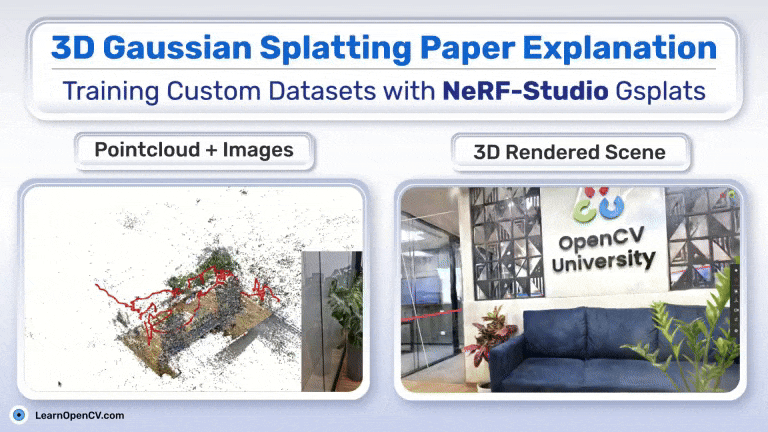
In geospatial contexts, this technique excels for terrain visualization by preserving fine details like elevation gradients and surface textures from point clouds or drone imagery. For instance, tools like ArcGIS integrate it with LiDAR data, achieving sub-centimeter accuracy in photorealistic models while reducing computation time compared to NeRF’s volumetric sampling. The adaptive densification process—splitting under-detailed Gaussians and pruning over-dense ones—ensures scalability for large-scale topography, such as urban Bengaluru’s varied elevations. Viral demos on X highlight its use in radiance fields for immersive disaster simulations, where blending Gaussians captures soft edges and lighting effects absent in polygon meshes.
This method’s efficiency stems from GPU-accelerated alpha-blending, making it ideal for real-time applications in GIS software like ESRI’s ArcGIS Reality, where high-redundancy image captures enhance geometric fidelity.
2. AI-Driven Predictive Topography and GeoAI Tools
GeoAI integrates machine learning (ML) and deep learning (DL) with geospatial data to enable predictive modeling of terrain dynamics. Core to this is the fusion of satellite imagery, point clouds, and tabular data through tools like ArcGIS Pro’s GeoAI toolbox, which employs automated ML for classification and regression tasks. Predictive topography involves training models on historical datasets to forecast changes like erosion or subsidence, using spatial algorithms to detect patterns in elevation, slope, and land cover.
Technically, GeoAI workflows often start with feature extraction via convolutional neural networks (CNNs) on raster data (e.g., Sentinel-2 imagery for NDVI indices), followed by ensemble models (e.g., random forests or gradient boosting) for regression on variables like flood risk. Tools like GeoWGS84.ai automate this with spatial prediction models, enriching datasets with contextual layers for accuracy metrics like ROC-AUC > 0.9 in anomaly detection. In Bengaluru’s context, GeoAI has been applied to urban flood prediction by analyzing topography alongside precipitation and infrastructure data, reducing manual analysis time by automating cluster detection and change forecasting.
The strength lies in scalable data ingestion—handling petabytes via cloud platforms—enabling probabilistic predictions for resilience planning, though challenges include data bias in underrepresented regions.
3. Drone Networks and DePIN for Global Mapping
Decentralized Physical Infrastructure Networks (DePIN) combined with drone swarms are revolutionizing global topography mapping by creating verifiable, on-chain datasets. DePIN leverages blockchain for incentivizing node participation, where drones act as sensors in a peer-to-peer network, capturing high-resolution imagery tiled into uniform grids (e.g., 25-acre Spexigons). Technical integration involves RTK/PPK GNSS for centimeter-level georeferencing, fusing photogrammetry and LiDAR to generate orthomosaics and digital elevation models (DEMs).
In DePIN architectures, drones contribute to overlay networks for data transmission, with blockchain ensuring immutability via token rewards for validated contributions (e.g., environmental monitoring or mapping). Projects like Spexi or Arkreen use flywheel models: user fees boost token value, incentivizing more deployments, leading to exponential network growth. For topography, this enables real-time updates to global DEMs, surpassing satellite limitations in resolution and frequency, with applications in Bengaluru’s smart city initiatives for infrastructure mapping.
Challenges include coordinating autonomous flights and integrating with GIS via APIs, but the decentralized model reduces costs by 80% compared to centralized surveys.
4. Viral Terrain Anomalies and Earth’s Curvature Demos
Viral discussions on terrain anomalies often stem from gravity field variations, visualized through anomaly maps where deviations from a reference geoid highlight subsurface density differences. Technically, these are computed using spherical/ellipsoidal approximations, with tools like TGF software calculating functionals like geoid height and gravity anomalies from DEMs via prism or tesseroid integrations. Anomalies near sea level—e.g., disproportionate land just above zero elevation—challenge uniform distribution models, amplified by Earth’s curvature in signal propagation demos.
Predictive methods compare VG (vertical gravity) and VGG (gradient) anomalies, with VGG more sensitive to short-wavelength topographic fluctuations due to its 1/r^3 decay versus VG’s 1/r^2. In geospatial analysis, satellite data from GRACE reveals global patterns, aiding inversion for bathymetry or subsidence prediction with errors <1 m in tested sea areas. Viral X threads on curvature demos use line-of-sight calculations in wireless planning, incorporating refraction and terrain profiles for accurate anomaly mapping.
These insights drive policy debates on climate impacts, with Bengaluru’s coastal proximity highlighting subsidence risks from such anomalies.
5. Digital Twins and Multi-Domain Terrain Layers
Geospatial digital twins are virtual replicas anchored in coordinate systems like WGS84, integrating multi-domain layers (terrain, infrastructure, environment) for simulation. Architecturally, they comprise data ingestion layers fusing GIS (e.g., CityGML for 3D objects), IoT sensors, and ML models for real-time synchronization. Terrain layers use LiDAR-derived DEMs as foundations, overlaid with semantic data for multi-scale analysis—from buildings to cities.
Key to multi-domain integration is bidirectional data flow: physical changes update the twin via APIs, enabling predictive simulations (e.g., flood scenarios via physics-based models). Tools like Esri’s ArcGIS create these with geospatial foundations, supporting analytics like energy optimization or resilience planning. In Bengaluru, digital twins layer topography with utilities for smart city management, reducing maintenance costs by 18-25% through AI-driven insights.
Scalability relies on cloud computing for handling petabyte-scale data, with emerging standards ensuring interoperability across domains.
| Trend | Technical Core | Viral Driver | Bengaluru-Relevant Impact |
|---|---|---|---|
| Gaussian Splatting | 3D Gaussian ellipsoids with SH for view-dependent rendering | Real-time photorealism in GIS demos | Enhanced urban elevation models for flood zoning |
| GeoAI Predictive Tools | ML ensembles on spatial data for regression/classification | Automated risk forecasting interfaces | Predictive subsidence analysis in tech hubs |
| Drone DePIN Networks | Blockchain-incentivized GNSS/LiDAR drone swarms | Decentralized mapping flywheels | Scalable infrastructure grids for smart cities |
| Terrain Anomalies | VG/VGG anomaly inversion with ellipsoidal approx. | Gravity maps sparking climate debates | Coastal vulnerability assessments |
| Digital Twins | GIS-anchored multi-layer simulations with bidirectional sync | Integrated terrain/utility visualizations | Resilience planning for monsoons |
These trends underscore a convergence of AI and geospatial tech, promising more accurate, dynamic topography models. As they gain traction, expect broader adoption in sustainable development, especially in dynamic urban landscapes like Bengaluru.