

In the US real estate market, selling faster is rarely about price alone. Buyers take time because they are evaluating risk, lifestyle impact, long-term value, and daily convenience. While floor plans and interior visuals matter, location remains the single most decisive factor in real estate purchasing decisions. This is why US real estate developers increasingly rely on location maps as core sales tools, not just marketing visuals.
When designed correctly, location maps reduce uncertainty, accelerate buyer confidence, and significantly shorten the sales cycle.
Location Is the First Question Buyers Ask
US homebuyers and investors typically begin with location-related questions:
- How close is the property to work, schools, and transit?
- What amenities are nearby?
- How accessible is the neighborhood today?
- How will the area develop over time?
If these questions are not answered clearly and quickly, buyers delay decisions or move on. Location maps provide instant clarity by showing answers visually—often before a salesperson even begins speaking.
Turning Location Claims Into Visual Proof
Developers frequently describe projects as “well-connected,” “centrally located,” or “in a high-growth corridor.” Without visual support, these claims sound generic.
Location maps convert claims into evidence:
- Proximity maps show distances to schools, hospitals, airports, and employment hubs
- Connectivity maps highlight highways, metro lines, and commute routes
- Neighborhood maps reveal lifestyle infrastructure such as parks, retail, and dining
- Growth maps show planned infrastructure and development zones
When buyers can see these advantages, skepticism drops and confidence increases.
Helping Buyers Visualize Daily Life
A major cause of hesitation is a buyer’s inability to imagine daily routines in a new location. This is especially true for out-of-state buyers, relocations, and first-time homebuyers.
Location maps help buyers mentally place themselves in the area by showing:
- Nearby grocery stores and essentials
- Schools and childcare options
- Commute paths and travel times
- Recreation, dining, and social hubs
This visualization transforms the property from an abstract investment into a lived experience—often the emotional turning point that leads to a purchase decision.
Improving Site Visit Conversion Rates
Developers who use strong location maps before site visits see higher-quality leads and faster conversions.
When buyers arrive already understanding:
- How to reach the property
- What surrounds it
- Why the location matters
site visits become confirmation rather than exploration. Sales conversations shift from explanation to closure, reducing follow-up delays and repeat visits.
Supporting Faster Decisions for Investors
Investor buyers prioritize clarity and speed. They want to quickly assess:
- Rental demand potential
- Proximity to employment centers
- Infrastructure-driven appreciation
- Competitive supply in the area
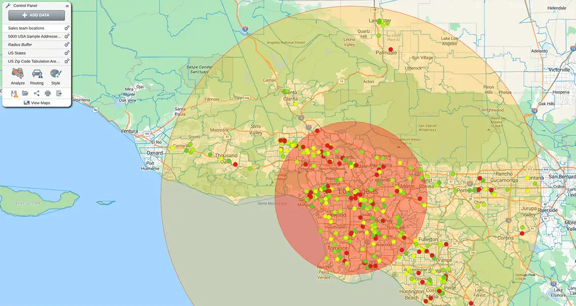
Location maps that overlay rental zones, job hubs, transit corridors, and future development plans allow investors to evaluate deals faster. This is especially important in competitive US markets where timing directly affects returns.
Reducing Sales Team Dependency and Inconsistency
Without standardized location maps, sales teams rely heavily on verbal explanations. This leads to:
- Inconsistent messaging
- Overpromising or vague claims
- Buyer confusion
- Longer decision timelines
Custom location maps create a shared visual language. Every salesperson communicates the same advantages, accurately and confidently. This consistency builds trust and reduces buyer hesitation.
Addressing Buyer Objections Proactively
Common buyer objections often relate to location:
- “It feels far.”
- “Is the neighborhood established?”
- “What about traffic?”
- “Will this area develop?”
Well-designed location maps address these objections proactively by:
- Showing actual distances and travel routes
- Highlighting existing infrastructure
- Differentiating current vs planned development
- Placing the project within a broader city context
By resolving concerns visually, developers reduce back-and-forth discussions that slow down deals.
Supporting Digital and Remote Sales
US real estate sales increasingly involve remote buyers—NRIs, interstate relocations, and investors. In these cases, location maps become even more critical.
Embedded maps on websites, shared PDFs, and virtual presentations allow buyers to:
- Explore the area without visiting
- Compare projects remotely
- Share visuals with family or advisors
- Make decisions with greater confidence
Developers who invest in strong digital location maps close deals faster with remote audiences.
Accelerating Executive and Lender Approvals
Location maps are not just sales tools—they support internal and external approvals.
Developers use them to:
- Secure faster leadership buy-in
- Explain project positioning to lenders
- Support zoning and planning discussions
- Align marketing and sales teams
Clear geographic context reduces internal friction, helping projects move to market and sell faster.
Interactive Maps vs Static Brochures
Many US developers are moving beyond static brochure maps to interactive experiences. Interactive location maps allow buyers to:
- Zoom into areas of interest
- Toggle amenity layers
- Explore commute routes
- Compare nearby developments
This interactivity keeps buyers engaged longer and answers questions instantly—often shortening sales cycles by eliminating follow-up calls.
Best Practices US Developers Follow
Successful developers treat location maps as strategic assets. Common best practices include:
- Clean, uncluttered design
- Accurate distances and travel times
- Clear distinction between existing and future infrastructure
- Mobile-friendly layouts
- Brand-aligned visuals
- Regular data updates
Poorly designed or misleading maps slow sales and damage credibility.
Why Location Maps Work So Well
At their core, real estate decisions are about reducing uncertainty. Location maps excel at this because they:
- Provide instant context
- Replace lengthy explanations
- Build emotional and rational confidence
- Support faster internal and external alignment
When buyers understand location clearly, they decide faster.
Final Thoughts
In the competitive US real estate market, attention is short and buyer expectations are high. Developers who rely solely on brochures and verbal narratives often lose momentum. Those who use clear, honest, and well-designed location maps gain a decisive advantage.
By turning location into visual certainty, US real estate developers shorten sales cycles, increase trust, and close deals faster. For modern real estate marketing and sales, location maps are no longer optional—they are essential.